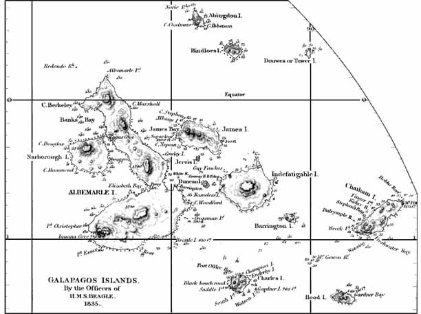
Aaron Arrowsmith's 1839 map is almost entirely accurate. It was compiled from the data provided by Fitzroy's 1835 expedition to the Galapagos which was but one stop on a circumnavigation whose main purpose was to chart poorly known areas. Fitzroy's efforts resulted in the 1845 Admiralty map, which itself was the basis for all modern maps (e.g. 1942 U.S. Navy chart) up until satellite imaging techniques in the late 20th century. However, this voyage is primarily remembered for the reports of the Galapagos' most famous visitor, Charles Darwin. In this map, bathymetric (sea depth) data is given and the islands have names of which some are still widely used, although the Ecuadorians gave the islands Spanish names upon their official annexation in 1832.
(with permission from John Woram's collection)