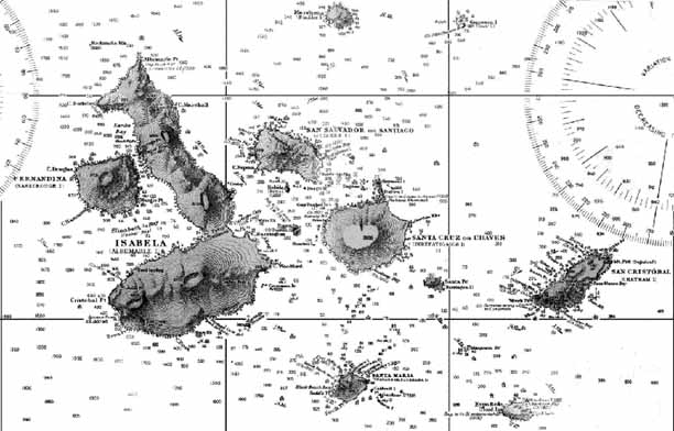
This U.S. Navy chart represents the culmination of four hundred years of cartography and is almost perfectly accurate (some detail of the interior of Santa Cruz is missing) before satellites (compare with Modern maps). High level aerial photography was the only way to check maps based on ground observations. The map was producd in 1942 in response to the realization of the Galapagos' strategic importance for a war in the eastern Pacific a very real threat after the Japanese attacked Pearl Harbor in 1941. The U.S. set up a base on Baltra Island at the northeastern tip of Santa Cruz. This small island is a slab of volcanic rock flat enough for an airstrip and approximately centrally located, hence ideal for a military base. The airstrip remains in use to this day as main entry point in the islands for the majority of visitors who arrive by air. The circular markings on the chart are navigation aids and the little numbers are bathymetric data. Note that this chart bears the official Ecuadorian names. Presumably the U.S. authorities were sensitive to Ecuador's ownership of the islands.
(with permission from John Woram's collection)

 back to antique maps